The state is on a fast-track to developing a land plan required by the Michigan Legislature as a condition of potentially removing caps on acquiring more state-owned land. MEC’s Brad Garmon has provided this helpful overview for MEC member organizations and others interested in tracking or influencing this process.
What is the “Land Plan”?
The Michigan Department of Natural Resources (DNR) is accepting public input on a draft document outlining a proposed strategy to guide how the state acquires, manages and sells public lands.
The plan is a requirement of Public Act 240, the so-called “land cap” law that was passed in 2012. It strictly limits how much acreage the DNR can own. According to the law, the acreage cap can be lifted if the DNR develops a land strategy that is approved by the legislature.
More on the Land Cap can be found here, here and here.
What is the “land strategy” process and where are we now?
The “land cap” law gave the state until October, 2014, to come up with a draft plan, but the Governor has tightened the timeframe, giving the DNR until next month (May).
The DNR assembled the current draft in a few short months, pulling in many of the department staff to help and meeting three times with a “stakeholder” advisory group that included MEC, MUCC, Parks and Recreation professionals, and representatives from timber, oil and gas industries.
The DNR is currently presenting the draft plan at regional meetings around the state and in focus groups with local and regional economic development professionals and key leaders. The schedule of public meetings can be found on the DNR’s land strategy website, along with a ton of maps and background information.
In addition to the public meetings below, written comments on the draft strategy will be accepted until April 30 at: [email protected]
Too much land?
We at MEC hear all the time from legislators who say that the DNR owns “too much land.” The primary reasoning behind this argument is that the DNR either 1) doesn’t have the money to properly care for what it has, or 2) the locals are not being compensated fairly for the land, i.e., the DNR isn’t going to allow them to develop the land and yet it’s not paying local property taxes like private landowners would.
Both arguments seem pretty flimsy to us, especially coming from the legislature (i.e., the folks who are responsible for appropriating enough money to pay the local governments their full Payments in Lieu of Taxes to replace tax revenue that otherwise might have been generated on the land, and who have cut nearly all general fund support for the DNR, forcing them into a “pay to play” model that too often favors revenue-generating activities over good natural resource policy).
Accurate or not, those two arguments were the driving forces behind the draft land strategy that’s currently out for review. But more importantly, we think both questions miss the point – why does the DNR own land?
What are we talking about when we say “public land?”
There are lots of different owners of “public land” in Michigan, from your local parks department to the National Park Service. But the conversation in Michigan right now is all about the DNR, which currently “owns” about 4.6 million acres of land.
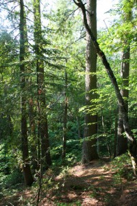
The DNR has about 100 State Parks catering to campers, swimmers and travelers, and various game areas and recreation areas for hiking, biking and hunting among other activities. But by a long shot the vast majority of DNR land (more than 3.5 million acres) is timberland, and it’s all in the northern reaches of the state. The entirety of the parks and recreation system that most of us will know and use, by contrast, amounts to about 350,000 acres—barely a tenth of the state forest system.
So in reality, the big number – 4.6 million acres — that legislators like to throw around doesn’t tell the true story. Read more


